- Telecom's most precise RF clutter dataset
- Signal-aware classes, per-pixel heights
- Nationwide at 1m resolution
Industry-leading RF clutter intelligence
EarthDefine Clutter 3D is our top-of-the-line 20-class RF clutter dataset covering the entire continental US at 1-meter resolution. You get a rich 5-layer product with the same fidelity in rural Wyoming as in downtown Chicago, and no gaps. Every pixel carries an exact height value derived directly from LiDAR, to remove the need for estimations.
Plan with confidence, knowing that you are getting the highest value.
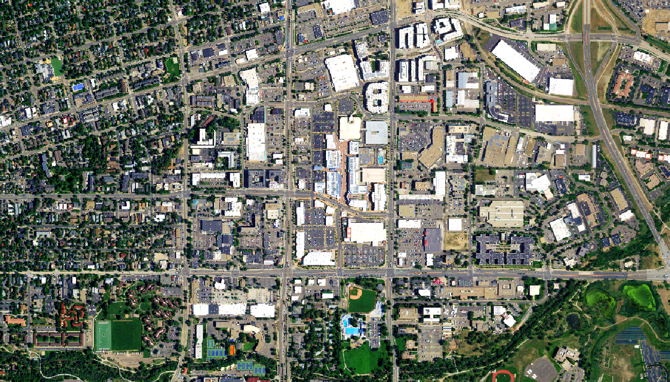
See what's inside a Clutter 3D delivery
Toggle the layers below to explore all five datasets included in every order. If you'd prefer to work with the data directly, download a free sample and load it into your platform of choice.
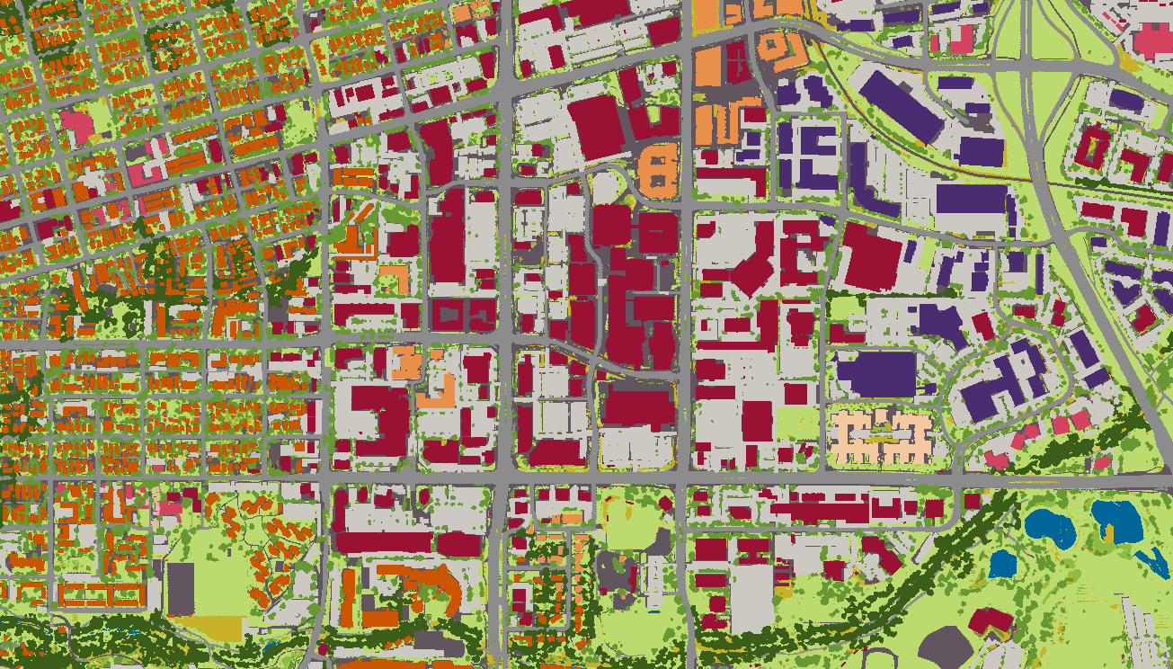

20-class clutter schema
Most clutter datasets were designed for land use monitoring, not RF engineering. Class boundaries don't reflect how signal behaves, heights are estimated, and resolution is too coarse to distinguish a building from the tree line behind it.
Our 20-class schema is built differently: every class reflects RF propagation behavior, every pixel carries a LiDAR-measured height value, and the schema spans the full range of environments you'll encounter across the continental US. From open rural terrain to dense urban cores, no gaps. Explore the classes below to see exactly what you're working with.

Hover any row below to preview
| Clutter Class | Description |
|---|---|
| 10. Water | Sea, ocean, river, pond, lake (excludes swimming pools) |
| 20. Bare Earth | Soil, sand, rock, clearings |
| 30. Vegetation 4 classes | Trees, shrubs, ground cover, crops |
| 31. Ground-level Vegetation | Fields, grass, ground cover, low crops, turf |
| 32. Low Vegetation | Shrubs and herbaceous |
| 33. Tree, Low Density | Part of small clump |
| 34. Tree, High Density | Part of large contiguous canopy |
| 40. Residential Buildings 3 classes | Single/multi-family housing at varying densities |
| 41. Residential, Low Density | Isolated structures (e.g., rural residential) |
| 42. Residential, Med. Density | Buildings forming small clumps |
| 43. Residential, High Density | Buildings forming large contiguous clumps |
| 50. Commercial Buildings 3 classes | Office, mall, institution, community facility |
| 51. Commercial, Low Density | Isolated buildings not part of clump, e.g., rural |
| 52. Commercial, Med. Density | Buildings part of small clump, e.g., suburban corridor |
| 53. Commercial, High Density | Buildings part of large clump, e.g., CBD |
| 60. Industrial Buildings 3 classes | Factory, plant, heavy goods storage |
| 61. Industrial, Low Density | Isolated industrial structures |
| 62. Industrial, Med. Density | Buildings part of small clump |
| 63. Industrial, High Density | Buildings part of large clump |
| 70. Transport & Impervious 5 classes | Paved surfaces and transportation corridors |
| 71. Parking | Surface parking lots and structures |
| 72. Roads | All paved road surfaces |
| 73. Railways | Rail corridors and associated structures |
| 74. Airports | Runways, taxiways, and airport grounds |
| 75. Other Impervious | Paved or hardened surfaces not classified elsewhere |
20 classes. LiDAR heights. Building vectors. One stack.
Download a Free SampleNot all land cover data is built for RF planning
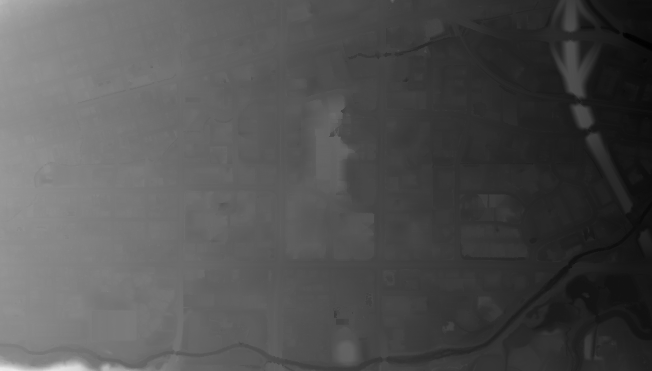
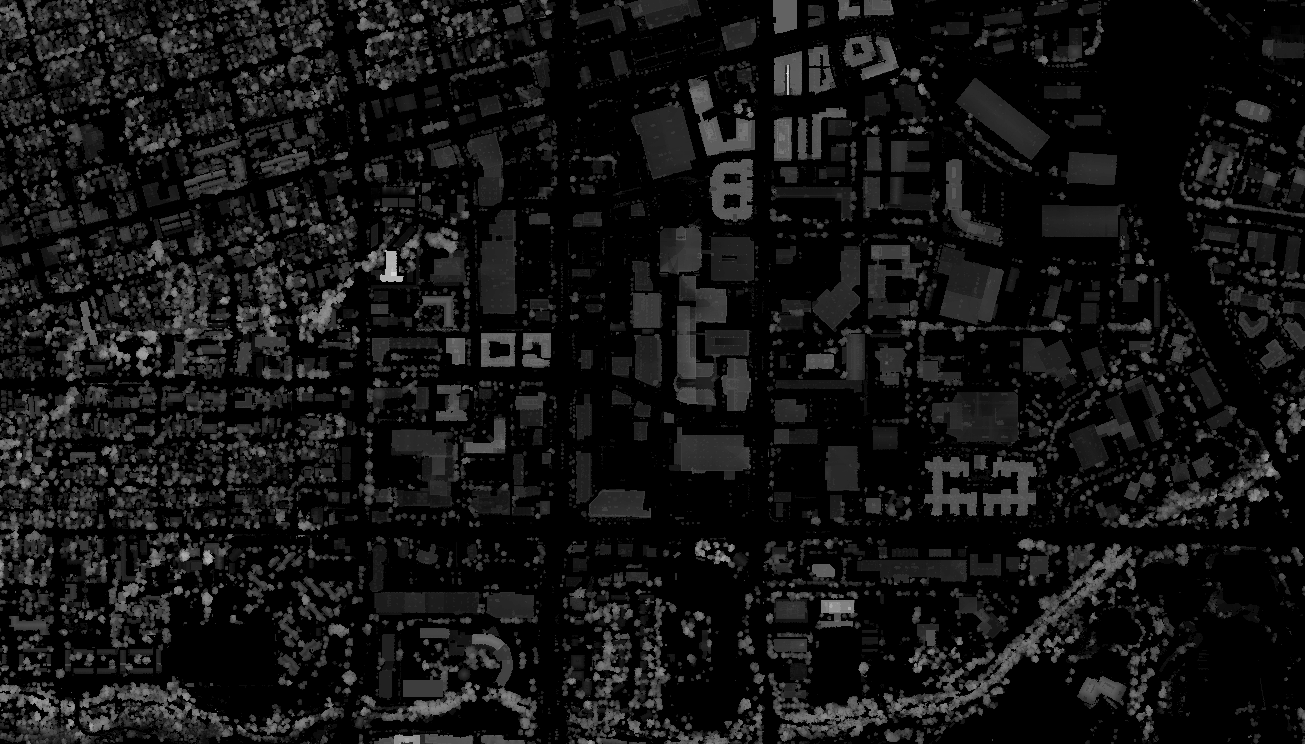
At 10m resolution, a tree and the building behind it can occupy the same pixel. Height values are estimated rather than measured. Your propagation model is only as accurate as your clutter data.
Here's how a typical 10m product compares to EarthDefine's 1m product for the same area.
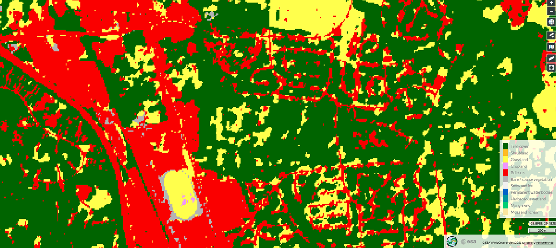
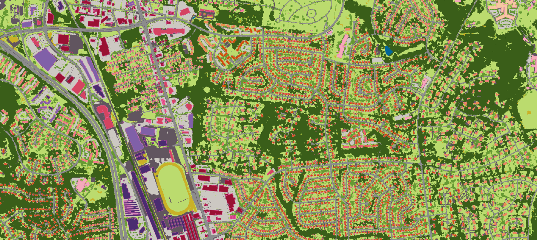
EarthDefine's Clutter 3D is built to solve RF engineering problems: 1m resolution, LiDAR-measured heights, and 20 classes that reflect how signal actually interacts with the environment.
Everything your RF model needs, in a single delivery
Download a Free SamplePan-US coverage. Every market, every geography.
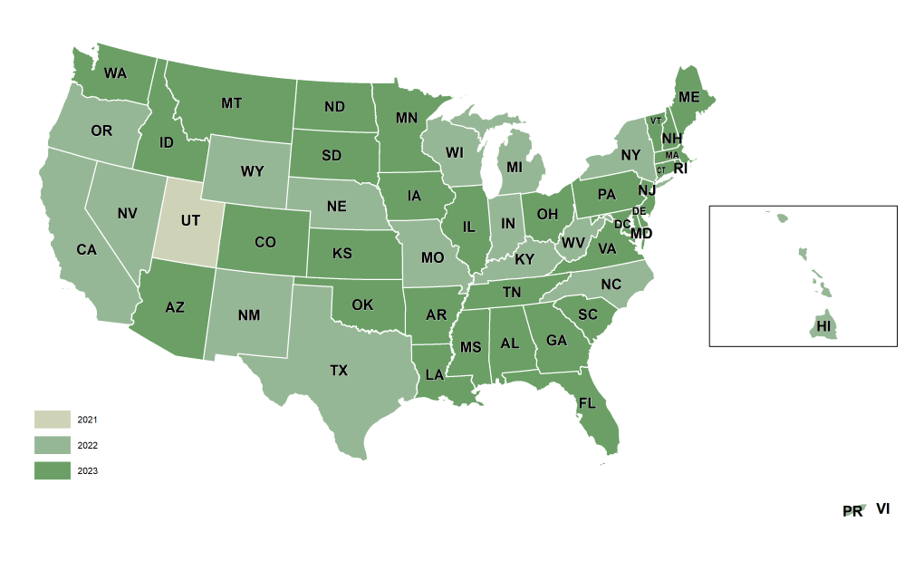
EarthDefine Clutter 3D is available as a seamless, ready-to-deliver dataset for any area within the United States. No stitching, no gaps, no waiting for data production.
3,125,942 square miles
Covering contiguous U.S., Puerto Rico, and the U.S. Virgin Islands.
Data coverage and freshness
NAIP acquires roughly half the continental US every year. As each new cycle completes, EarthDefine produces updated clutter data for affected areas, so your models always reflect the latest available imagery, not a legacy snapshot. Every dataset includes source imagery metadata to ensure that your predictions are reproducible and defensible.
Related Products
Tree Map
Tree Locations
Canopy Height Model (CHM)
Building Footprints 3D
Impervious Map
2026 © All Rights Reserved.