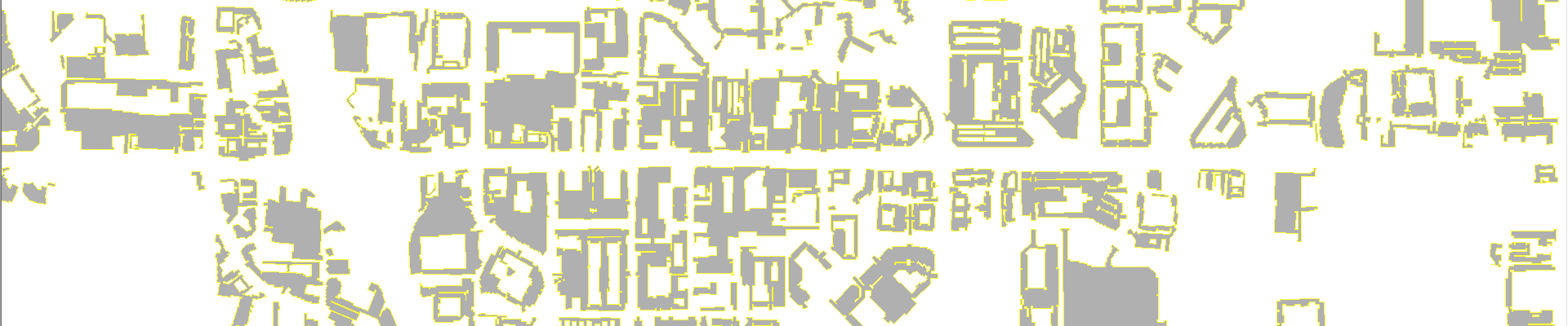
EarthDefine Parking Lots
- Nationwide map of outdoor parking lots
- AI-derived polygons with area estimates
- Available off-the-shelf
Rapid Updates
New imagery every year means your parking data stays up-to-date as landscapes change.
Accuracy
Our AI is trained to accurately map outdoor parking spaces that are over 1000 sq. feet.
Address-linked
Street addresses and adjoining building footprints provide complete spatial context.
How industry leaders use parking intelligence
The Parking Lots dataset provides GIS-ready parking polygons to support a host of mapping and spatial analysis functions. Example applications include:
- Providing better guidance for last mile delivery operations for loading and unloading deliveries
- Identifying places to locate Electric Vehicle (EV) charging infrastructure
- Assessing lots for conversion to covered parking for installing solar panels
- Locating potential sites for residential or commercial development
- Targeting of customers based on their parking locations to improve mobile marketing
- Finding locations for public health outreach
- Understanding urban growth and urban heat islands
- Locating sites for ride sharing pickup and dropoff
Data coverage and freshness
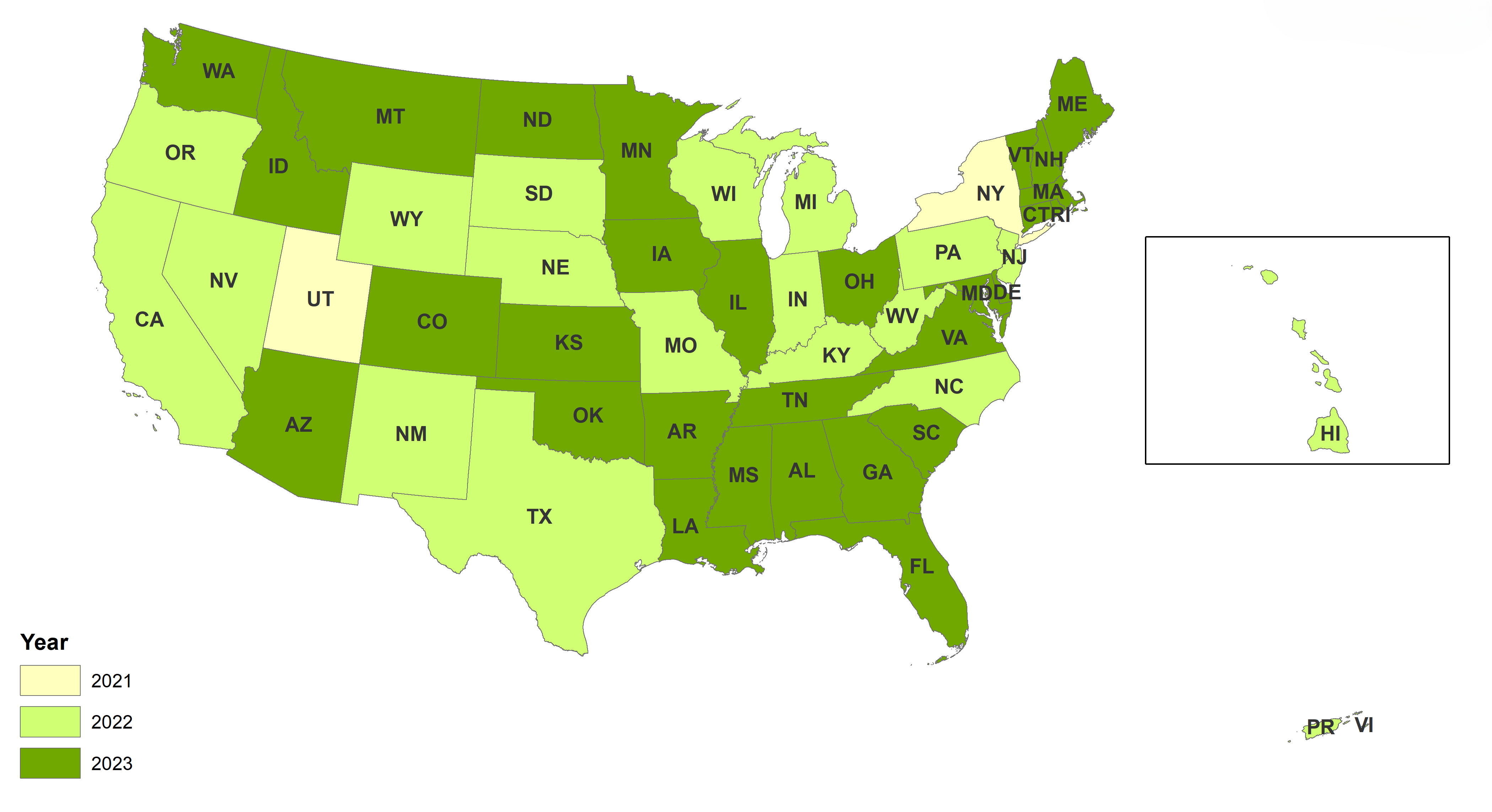
| Technical Specifications | |
|---|---|
| Source | 60cm Imagery |
| Dates | 2021-2023 |
Download and Evaluate
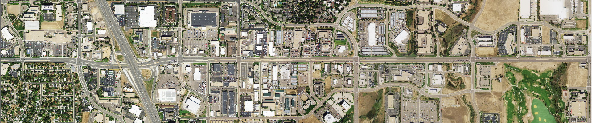
Simi Valley, CA
Overland Park, KS
Overland Park, KS
Looking for samples for a specific region?
Our data experts can generate a sample for your region of interest.
Request Data